Photography and water have a deep bond. Shaped by water, weather, and human utilization, the shoreline is both a natural environment and a social place. Through the photographer’s lens, the purpose of this article is to explore, through observation rather than captured moments, what the shoreline, which results from water and weather and, more specifically, from human behavior, has to do with what the beach offers.
The magnitude of this relationship is considerable. In 2023, over 1.4 billion overnight stays had been recorded in coastal areas across the European Union. The coast of Spain attracted approximately 363 million tourists, Italy attracted 238 million, and the coast of France attracted 163 million. Such a phenomenon is not merely a matter of show and escape; it involves the increased interaction between human beings and the edge of the water body. From a photographer’s lens, these statistics represent not spectacle or escape, but rather the scaled-up, ongoing relationship between photography and water. In the following sections, we shall examine how photography and water help convey the relationship among people, water, and place.

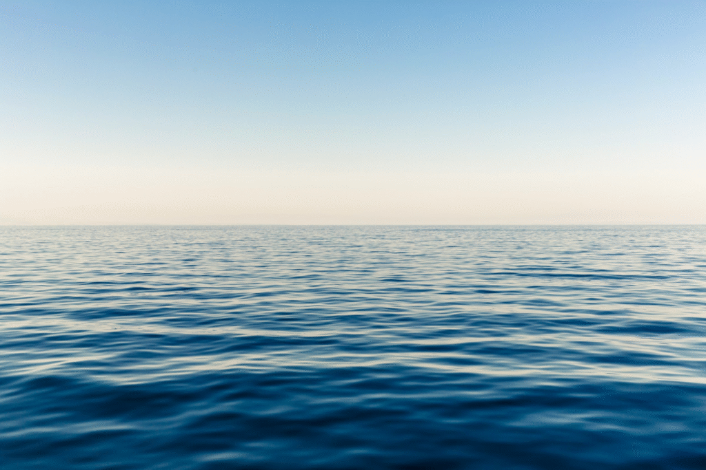
Water’s Form and Photographic Frame
A beach or shoreline environment is far from an inert backdrop. Its very presence bears witness to long-term patterns of wave energy, sediment movement, and tidal cycles that have shaped the coast for decades. Rip currents, surf, and the contours of the beach undergo constant changes, often within just a few hours. These patterns are embedded in the light, texture, and rhythm that a camera captures, making photography and water a vital tool for observing dynamic coastal processes. Recent research using photography and water, as well as videography and image segmentation, shows that photo series can be as effective as scientific measurements in detecting and analyzing moving water bodies, such as rip currents, along shorelines worldwide.
The Coastal Monitoring Programme in England and Wales monitors wave, tide, and topographic variables along over 2,450 km of coastline. Data included real-time wave heights, tidal levels, wind speeds, aerial photography, LiDAR elevation models, and long-term topographic beach surveys. These datasets provide a measurable understanding of the interaction between water and land and a rich scientific context in which photographers can capture coastal change. The program links scientific monitoring, human observation, citizen science initiatives, photography and water projects, creating a bridge between measurable coastal dynamics and visual narratives of people engaging with the shoreline.

People, Place, and Citizen Science
Beaches are far from being mere sites of tourism; they are the hotspots of human observation, ecological acquaintance, and creative interaction. In addition to taking personal photographs, citizen science projects enable laypeople to record their observations about coastlines, wildlife, and litter.
On a global scale, events such as the International Coastal Cleanup (ICC) involve participation by several million people annually. EU coastal cleanups alone involved, in 2024, over 12,000 volunteers in 53 countries and clocked several tons of waste. On a similar scale, Ireland’s Big Beach Clean Weekend involved 15,000 participants to record litter patterns to aid policy change. Just as photographers like Clark Little capture the dynamic interplay of waves, light, and human activity on shorelines, these citizen science initiatives demonstrate how people actively observe, document, and engage with beaches – turning both scientific and visual observation into meaningful storytelling and ecological record-keeping.
In New Zealand, the Litter Intelligence project trains local residents to participate in the country’s first comprehensive beach litter baseline, while the COASST project in the Pacific Northwest of the United States trains locals to monitor stranded seabirds, since its beginning, over 4,500 participants on more than 450 beaches spanning four states have contributed directly to monitoring their local marine resources and ecosystem health.
Alongside these citizen science projects, photographers such as Zak Noyle are capturing the dynamic intersection of humans, wave patterns, and coastlines in ways that complement scientific observation. Noyle’s immersive surf and ocean photography – published internationally and recognised with awards such as Surfer Magazine’s 2011 Photo of the Year – transforms the raw energy of water and shoreline interaction into compelling visual narratives that reflect both environmental patterns and human engagement with the sea.

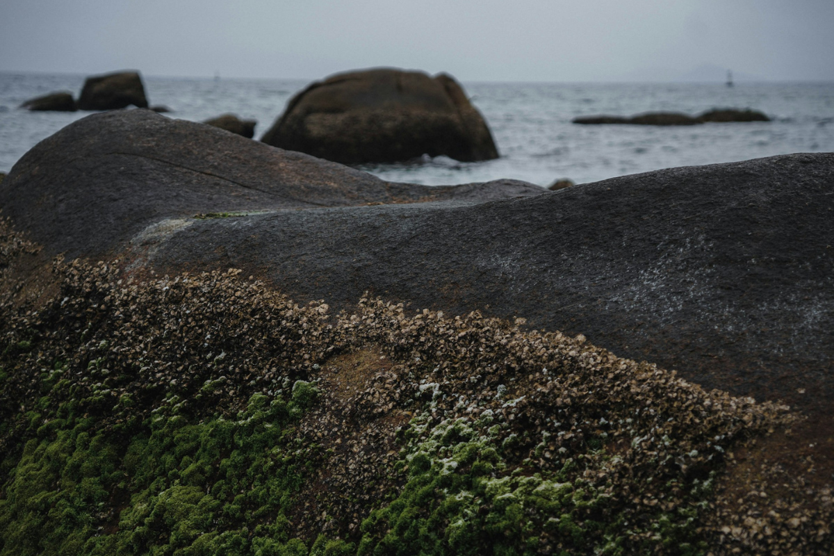
Ecological Edges and Temporal Layers
Beaches are ecotonal edges where marine and terrestrial life meet. Photographs may capture a wave crest or a sandbar, but can also document biological interactions such as shorebird foraging or patterns of macroalgal accumulation. These kinds of visual records, if repeated over seasons, can be qualitative complements to formal ecological surveys.
The seasonal dimension of beaches makes them particularly rich subjects for photographic observation. In temperate zones, morphological features shift between calmer summers and storm-energized winters. Every sequence thus provides a time-stamped narrative of the water’s persistent shaping force.

Photography and Water as Inquiry, Not Escapism
To observe beach life through photography is to acknowledge the measurable world that exists as the image’s context. Since the first ICC in 1986, 18 million volunteers have documented marine debris around the world, beaches that are part of citizen science projects that number in the hundreds, and the literal tens of billions of evenings that beach-goers spend in those regions. It is important to recognize that the peaceful shoreline depicted in the photo is also a site of scientific discovery.
Good observational photography and water encourage thought about the ways in which water enables and changes. Be it the impact of winter storms on dunes, litter patterns observed in relation to the photographic frames, or the expansion and contraction of the tidal flats from dawn through to dusk, beach imagery offers the possibility of revealing processes that work on a scale larger than the image. This way, photography and water become a lens for understanding the living dynamics of the coast.
Read More: